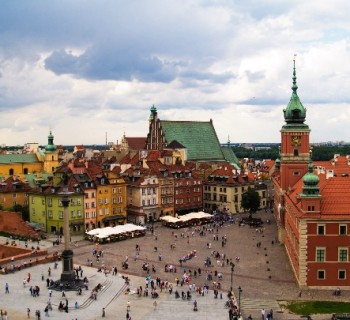
Warsaw metro: map, photo, description

Warsaw metro map
The Warsaw Metro currently consists of a single north-south line that links central Warsaw with its densely populated northern and southern suburbs. The first section of the Warsaw metro opened in 1995 and the line gradually expanded until it reached its planned length by October 2008. In the future plans of the city authorities to expand the metro and build stations, the construction of which was previously postponed due to cost savings.
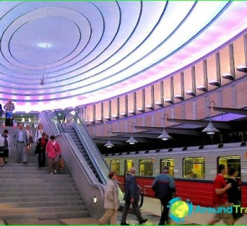
In 2009, the Warsaw Metro won two awards: «For attitude to the environment» and «Best Maintenance Program». In addition, the Warsaw metro is well known for its beautifully designed stations (for example: from S1odowiec station to M1ociny, Plac Wilsona or Ratusz-Arsenal)
Plans to build an underground rail system originated as early as 1918, when the idea was first expressed in the days when Warsaw regained its status as the capital of Poland. The subway was expected to solve transport problems in the densely built city center. The Great Depression buried these plans - Poland, like the whole world, experienced economic difficulties. In 1934, with the election of the new mayor of Warsaw, Stefan Starzinski, new work began on the Warsaw metro project - construction was planned to begin in the late 1930s. In total, 7 lines were to be built in 35 years. Work began in 1938, but World War II put an end to the ambitious endeavors. Short stretches made in 1938 serve today as wine cellars.
Warsaw was badly damaged during the Second World War. And although most of the pre-war projects were forgotten, Polish engineers who survived the war returned to their city to take part in its revival. However, the new communist authorities in Poland saw the future of the city in their own way. In 1950, at the height of the Cold War, Soviet strategic plans called for the creation of a secure transport link across the Vistula River. One of the ways to achieve this goal was the creation of a deep (up to 46m underground) underground in Warsaw, which will be interconnected with the railway network and can serve as an underground tunnel for the transfer of troops.
Construction work began almost simultaneously at 17 different locations on both sides of the river. By 1953, only 771 meters of tunnels had been built, however, after the death of Joseph Stalin, all work was stopped under the pretext of technical difficulties..
In 1984, a new metro construction program emerged, which was approved by the government and the first tunnels were built. Lack of funds, poor planning and bureaucratic rampant led to the fact that the work was carried out very slowly, at a speed of no more than 2 meters per day. And yet, in 1995, the Warsaw metro with 11 stations was opened. Now the line has 21 stations and a length of about 20 kilometers..
Perhaps the Warsaw metro is the only metro in the world where tickets are not sold by the transport company itself, but are offered in post offices and in private shops and kiosks. However, at the same time, tickets are valid for all types of transport, including metro, buses, trams and some suburban trains. In addition to tickets for one trip or one and several days, you can purchase a travel card for a long time, which is a budget alternative to single tickets. There are no turnstiles in the Warsaw metro, so you should punch your ticket yourself.
Photos of Warsaw metro
-

Warsaw metro map
-

-

-
-