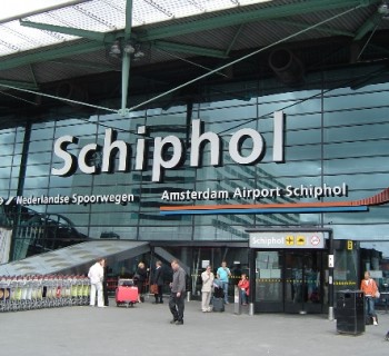
Provinces of Holland

The most populous European country, the Kingdom of the Netherlands occupies only 41.5 thousand square meters. km of territory on the political map of the world. The state is in 132nd place in the world in terms of area and 64th in terms of the number of citizens living here. The country's territory is divided into several administrative regions called provinces. By the name of two of them - North and South Holland - the country got its unofficial name, which is widespread among travelers. All provinces of Holland or the Netherlands have their own elected self-government body called Provincial States.
Monument to perseverance and hard work
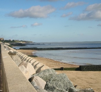
Until 1986, only 11 provincial names could be read on the map of the country. Then the hardworking Dutch literally conquered new lands from the sea, draining almost 2.5 thousand square meters. km. wetlands. The newly formed province was named Flevoland..
New lands spread out on the territory of Lake IJsselmeer, drained and reclaimed from the sea. The reclamation process lasted almost sixty years, and the impetus for the construction of the dam, which made it possible to do this, was the destructive flood in 1916..
On the territory of this province of Holland, there are many significant tourist sites, the most famous of which are the fishing village of Schokland, which received the status of a UNESCO World Heritage Site, and the lighthouse of the village of Urk..
Statistics know everything
Each province of Holland is interesting in its own way. On the territory of some of them there is a large number of historically significant architectural and cultural sites, while others boast unique nature reserves and national parks. Statistical information about the provinces of Holland may be of interest to the curious traveler:
- The largest population in South Holland. It is considered their home by three and a half million people..
- The largest area is occupied by the Dutch provinces Gelderland and North Brabant - 4971 and 4916 thousand square meters. km. respectively.
- The population density in the provinces of Holland is everywhere sufficient, but the "closest" of all are the inhabitants of South Holland, Utrecht, North Holland and Limburg. For every square kilometer in these territories there are from 1042 to 507 people.
- Almost all provincial capitals in Holland are of particular interest to tourists. Haarlem and Middelburg, Utrecht and Maastricht, Lelystad and, of course, The Hague are favorite places for entertainment and educational tourism among travelers all over the world.