Rivers of Tajikistan
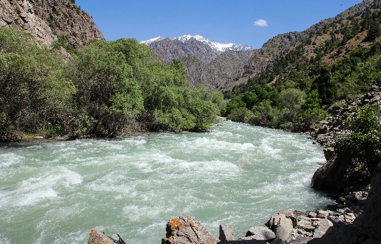
The rivers of Tajikistan are full-flowing and mainly belong to the Aral Sea basin. And only a few flow into the waters of Lake Karakul or the Tarima River.
Amu Darya river
The channel of the Amu Darya passes through the territory of four countries at once - Afghanistan, Tajikistan, Uzbekistan and Turkmenistan. The total length of the channel is 2,400 kilometers. Of these, 1,415 kilometers pass through the country. The source of the Amu Darya is formed by the confluence of two rivers - Vakhsh and Pyanj. The mouth of the river - the waters of the Aral Sea (when it flows into a large delta).
There are few tributaries near the river. On average, the Amu Darya receives the waters of Kafirnigan, Surkhandarya and Sherebad, as well as one left tributary - the Kunduz River. And further, up to the place of confluence, there are no more tributaries. The waters of the river are actively used, and therefore the Amu Darya does not reach the Aral Sea. This is what became one of the reasons for its drying out..
In the waters of the Amu Darya, there are quite a few different varieties of fish: asp; bald man; aral catfish; bream; sabrefish; silver carp; White amur; hate.
Vanj River
One of the rivers, the channel of which is located exclusively on the territory of Tajikistan. It is a right tributary of the Pyanj River. The total length of the river is 103 kilometers. The source is formed by the confluence of two rivers - one descends from the glaciers of the Vanch ridge, the other - from the ridge of the Academy of Sciences (western slope). The channel runs between the Vanch and Darvaz ridges.
Kashkadarya river
Territorially, the river bed passes through the lands of Tajikistan (Sughd region) and Uzbekistan (Kashkadarya region). Conventionally, the river has three names: in the upper reaches - Obikhunda; the middle course - Shinachasai; lower - Maimanakadarya.
The total length of the channel is 378 kilometers. The source of the river is at an altitude of 2960 meters above sea level and is formed by two unnamed rivers. Main tributaries: Akdarya (Aksu); Tanhidizadarya; Guzardarya.
Muksu river
The total length of the channel is 88 kilometers. Muksu is located in the Jirgatal region of Tajikistan. The source is the confluence of two rivers: Seldara and Sauksoy (Fedchenko and Bolshoi Saukdar glaciers).
Kuzylsu river
Kyzylsu, which means «red river», flows through the territory of Kyrgyzstan and Tajikistan. The source is the slopes of the Trans-Alai Range. The total length of the channel is 235 kilometers. At the confluence with the Muksu River, it gives rise to the Vakhsh River.
Vakhsh river
The total length of the river channel is 786 kilometers, and they all pass through the territory of Tajikistan. The source of the river is located on the slopes of the Pamir, but the place of its confluence with the waters of the Pyanj River gives rise to the great Amu Darya. The river is the main source for irrigation as well as power generation.
