East China Sea
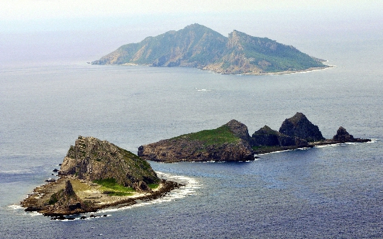
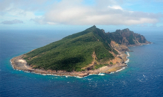
The water area of the East China Sea is located south of the Yellow Sea. The large islands Ryukyu and Kyushu share it with the Pacific Ocean. This sea is united with the Sea of Japan through the Korea Strait. The island of Taiwan defines its border with the South China Sea. Among the islands of the East China Sea, Senkaku and Socotra are of particular importance. Different peoples designate the reservoir in question in their own way. Chinese call him «Donghai» (East Sea) and Koreans - «Namhae» (South Sea). Earlier in Japan, the sea was called East China, but after 2004, the designation is used in official documents «East side sea».
Characteristics of the reservoir
The map of the East China Sea shows that sea routes from the Sea of Japan and the Yellow Sea pass through its water area. The area of the reservoir is approximately 836 sq. km. Its average depth does not exceed 300 m. The deepest place is 2719 m. The western regions of the sea are shallow. Closer to the island of Taiwan, the depth gradually increases.
Navigation in the water area is difficult. The character of this sea has been studied by the Chinese, Koreans and Japanese for centuries. However, it continues to give them a lot of trouble. The local climate is very changeable due to the mixing of cold air with the warm Kuroshio Current. There are dangerous reefs and rocks near the islands. After earthquakes, they appear or disappear under water. Sometimes it is impossible to distinguish them because of the muddy water. China's Yangtze River carries a large amount of sand and silt into the sea.
The sea relief periodically changes as a result of seaquakes. In the process of natural disasters, huge waves are formed in the sea. Longitudinal waves or giant tsunamis are formed here, which hit the coast. Local tsunamis look like a series of waves (up to 9), which propagate every 10-30 minutes at a speed of about 300 km / h. Tsunami waves can be up to 5 km wide and 100 km long.
Significance of the East China Sea
There are disputed islands in the water area. China and South Korea are arguing over Socotra Island. The PRC, Japan and Taiwan dispute the ownership of Senkaku territory. As for Socotra Island, local fishermen call it Iodo and associate many superstitions with it. In reality, Yodo is an underwater rock, the top of which protrudes above the water..
The coast of the East China Sea is rich in mineral resources. The largest ports on the planet are located in the area of this sea: Ningbo, Nagasaki, Shanghai, Wenzhou, etc. Here, sardines, herring, mackerel and flounder are fished. In the waters of the sea, lobsters and crabs are caught, seaweed and trepangs are collected. The ecological situation in the water area has greatly deteriorated in recent years. Most of the sea is pollution of the fourth degree (on a 5-point scale).
