Sea labrador
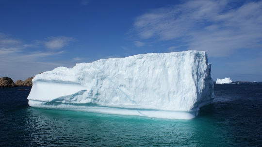
A vast stretch of the Atlantic Ocean near Greenland is designated by the Labrador Sea. The boundaries of the reservoir are marked near the islands of Newfoundland, Baffin's Land and the Labrador Peninsula. This sea is connected to the Hudson Bay through the Hudson Strait. It is connected with the Baffin Sea by the Strait of Davis. The Labrador Sea is located on the border with the Arctic Ocean, it is considered the northernmost body of water in the Atlantic basin. The sea area is approximately 840 thousand square kilometers..
Geographic features
The sea was formed about 40 million years ago as a result of the division of North America and Greenland. The seabed consists mainly of rocks of igneous nature, since earlier volcanoes were active in this region. The relief goes down to the southeast. The maximum sea depth is 4316 m. Shallow water is recorded in all coastal zones. The Labrador Sea map makes it possible to assess the coastline: it is indented by fjords, but there are no large peninsulas and bays in the water area. There are islands covered with steep cliffs near the coast. The coast of the Labrador Sea impresses with its unusual arctic beauty. The Northern Lights can be seen near the Labrador Peninsula.
Climate in the Labrador Sea Region
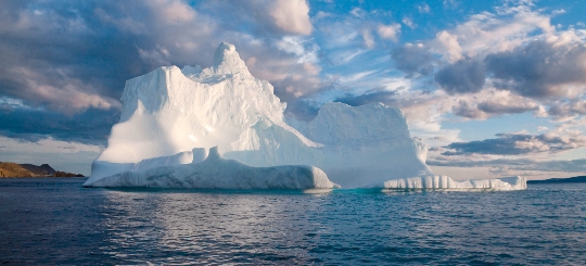
The area under consideration is characterized by a harsh climate. It is subarctic, so the reservoir is covered with ice even in summer. The coast of the Labrador Sea is inhabited despite very cold weather. Climatic conditions largely depend on the cold current that runs near the coast. Even in the summer season, the water temperature does not exceed +7 degrees. Icebergs drift on the sea all year round. In winter, most of the water area is occupied by ice. Navigation is difficult at sea. The Labrador Current flows from the Arctic Sea of Labrador. Cold water runs between Greenland and Canada, taking ice masses with it.
Using the sea
Severe climatic conditions are not an obstacle to the life of people on the coast. Local tribes settled in these parts for a very long time. The main occupation of the residents is fishing and whaling. Fish such as herring, hake and cod are found in the Labrador Sea. The flora and fauna are the same as in other arctic bodies of water. Here is the habitat of seals and seivals (whales from the order of baleen whales). Intensive fishing has led to the fact that the population of some species began to decline. Therefore, since 1992, it has been prohibited to fish for cod in the Labrador Sea. Beluga is also protected. There are no large ports in the water area, which has a beneficial effect on the environment.
