Irish sea

The shores of Ireland and Great Britain are washed by the waters of the Irish Sea. It belongs to the Atlantic Ocean basin. The Irish Sea map displays its bays: Wigtown, Loos, Morecambe, Solway Firth, Strangford Lough, Liverpool, Dublin, etc. St George's Strait unites the reservoir with the Celtic Sea. The North Strait connects the reservoir with the Atlantic.
Major islands in the water area are Anglesey and Maine. Small islands - Wali, Holyhead, etc. Along the coast there are many miniature bays and bays. The Irish Sea covers an area of approximately 47 thousand square meters. km. Its average depth is approximately 43 m. The deepest point is 197 m. Together with the straits, the width of the reservoir is 240 km, and the length is 210 km. The northeastern part of the island of Ireland is distinguished by its many capes. Basalt formations are located near Belfast, which make the landscape very picturesque..
History of the formation of the sea
The Irish Sea emerged on land about 1.6 million years ago. Previously, its water area was part of the continent of Europe. In ancient times, the waters of this sea were plowed by the Celts and Vikings. Camps and settlements arose on its banks. At present, fishing is well developed on the coast of the Irish Sea, as before. However, the ecological situation in the water area is considered bad. The Irish Sea was included in the list of the most radioactively contaminated natural objects in the world in 2001. The main reason for this is the work of the British Sellafield nuclear complex. Thanks to the activities of Greenpeace, the complex was stopped in 2003..
Climatic conditions
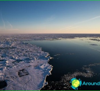
West winds are constantly recorded in the sea area. In winter, storms often occur here. The air in the winter months has an average temperature of about +5 degrees. In summer, it warms up to +15 degrees. The water temperature in winter is +7 degrees, in summer - about +15 degrees. The sea water has a salinity of 32 - 34.8 ppm. The Irish Sea has a mild winter.
The lowest temperatures are observed in coastal areas in January and February. For example, in Dublin, sometimes the air has a temperature of -16 degrees. The weather in winter is cloudy and unstable, with frequent fogs and rains. In summer, the region is cool, cloudy and damp. There are few sunny days here. In July and August, there are very warm days when the air warms up to +27 degrees.
Significance of the Irish Sea
The largest British port of Liverpool is located on the east coast. Manchester has access to the sea through the Manchester Canal. The port city of Dublin is located on the west bank. This port is of prime importance to Ireland. The main ports of importance for fishing are Fleetwood, Portavogi, Ardgrass, Kilkill, Skerris, Dan Leary, etc. The commercial fish are sprat, herring, whiting, cod, anchovies, flounder.