Islands of the Netherlands

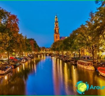
Part of the territory of Western Europe is occupied by the Kingdom of the Netherlands. Its area is approximately 41,525 sq. km. This state has borders with Belgium and Germany. In the north and west of the country, there are outlets to the North Sea. There are islands of the Netherlands in the Caribbean. These include the island of Aruba and the Netherlands Antilles.
Geographic characteristics
The Lesser Antilles archipelago includes land areas such as Curacao, Aruba and Bonaire. This island group is located near Venezuela. The smaller islands of Sint Maarten, Saba and Sint Eustatius also form a group in the northern part of the archipelago. Sint Eustatius is bordered by Saint Kitts and Nevis. Sint Maarten shares a land border with the French overseas territory of Saint Martin, as well as maritime borders with Saint Barthelemy and Anguilla. Bonaire is included in the Leeward Islands. It is located 30 km from the island of Curacao. Bonaire is washed from all sides by the Caribbean Sea. Not far from it is the uninhabited land area of Klein-Bonaire, which is also called Small Bonaire. Picturesque Bonaire, together with the islands of Saba and Sint-Eustatius, forms a Dutch possession - the Caribbean Netherlands. Today Bonaire is actually a municipality in the Kingdom.
Natural features
The islands of the Netherlands, such as Curacao and Bonaire, have a relief typical of the Caribbean region. They are the tops of seamounts located on the continental shelf. These are low islands surrounded by bays and lagoons. They are almost completely covered with tropical plants. There are also landscaped beaches and agricultural lands on these islands. The islands of Sint Eustatius, Saba and Sint Maarten are the summits of underwater volcanoes. They are characterized by an elevated relief and a rounded shape. Saba Island was formed on the site of a volcano that erupted more than 5,000 years ago.
The Dutch island in the Chesapeake Bay belongs to the islands of the Netherlands. It is a swampy land area located in Maryland. Previously, it was inhabited by farmers and boatmen, but gradually the island became deserted. Its western part began to collapse under the influence of tides and winds. Therefore, the local population was forced to move to a safer mainland..
Weather
The islands of the Netherlands in the Caribbean Sea have a tropical trade wind climate. Comfortable and warm weather prevails there, with minor temperature fluctuations over the seasons. In summer, the average air temperature is +27 degrees, and in winter it is +25 degrees. The trade winds blowing from the Atlantic bring rain to the islands. Bonaire and Curacao are located outside the hurricane-prone area. Sint Eustatius, Saba and Sint Maarten sometimes experience devastating hurricanes.