Coral sea

One of the most interesting and beautiful seas of the Pacific Ocean is the Coral Sea. Its water area stretches south of the island of New Guinea, near Australia. The sea is separated from the ocean by the New Hybrids, Solomon Islands and New Britain. A map of the Coral Sea shows that it is in the tropics, south of the equator. In the subtropics, there is only a small section of the reservoir. The Coral Sea links the Indian Ocean to the Pacific Ocean through the Torres Strait.
The area of the water area is approximately 4,791 thousand square meters. km. The sea is deep-water, since most of it is located outside the boundaries of the continental shelf. The most significant depth is 9140 m. This place is located next to the Solomon Islands and is designated as the Bougainville depression. The Coral Sea is an area of seismic activity. Over the past 150 years, the region has repeatedly experienced earthquakes up to magnitude 6. The most powerful earthquake happened in 2007 in the Solomon Islands. It had a force of 8 and caused a huge tsunami wave.
Features of the Coral Sea
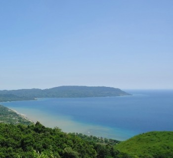
The sea got its interesting name due to the abundance of coral formations. The most significant coral reef on the planet is the Great Barrier Reef. He is in this sea and is protected by law. This natural structure is considered unique and included in the World Heritage List. The seabed has a highly dissected topography. There are frequent drops in depths and numerous depressions. The bottom in shallow water is covered with sand. The fauna and flora of the Coral Sea are impressive. Transparent sea water makes it possible to appreciate the variety of colors of the water area. Coral formations of all colors and shapes can be seen in the sea. The fauna is represented by a variety of free-swimming, crustaceans, benthic, molluscs and echinoderms.
Climate in the sea area
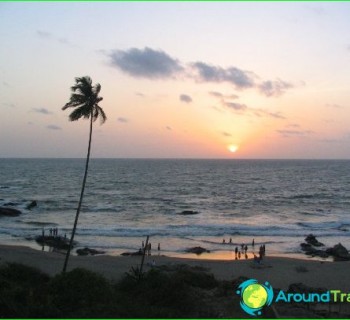
The Coral Sea coast is influenced by warm climates. The sea temperature is stable. It is kept at +29 degrees in the north. In the southern regions of the reservoir in August, the water temperature is about +19 degrees, and in February +24 degrees.
Significance of the Coral Sea
The water area has been considered Australian territory since 1969. The islands in the Coral Sea have no population. Only the Willis Islands have a working weather station. Major ports: Noumea, Port Moresby, Cairns, Brisbane. Navigation in the water area is difficult due to the abundance of coral reefs. Today, there are a number of economic and environmental constraints associated with the use of the resources of the Coral Sea. But its coastline is thriving. Major port cities are growing at a fast pace.