The map of Krasnaya Polyana, or rather the resort, which includes the villages of Estosadok and Rosa Khutor, can be an excellent help in preparing for the trip. Moreover, most of the lifts are located in Rosa Khutor, and in Krasnaya Polyana itself there is almost nothing. But I will have a separate post about this. In the meantime, in advance I propose to look at the maps and try to present your plan of action..
The content of the article
Third party cards
Maps are taken from the website http://riderhelp.ru/. You can follow the link, there are some more maps there. Hope the guys keep them up to date and the information is not out of date. At the moment, everything is relevant for 2015.
Please note that these maps are not oriented north-south, they are rotated 180 degrees for ease of presentation.
Summer cards (jpg)
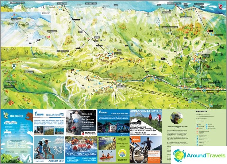
Krasnaya Polyana summer map
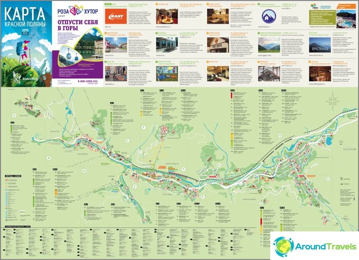
Krasnaya Polyana village map (clickable)
Winter maps (jpg)
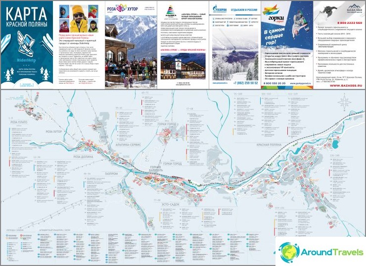
Map of all villages in Krasnaya Polyana in winter (clickable)
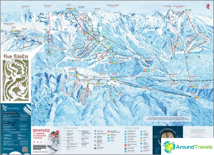
Map of the ski slopes in Krasnaya Polyana
My map with dots
The map is the points I marked on the OpenStreet Map. Moreover, almost all of them are on OpenStreet itself, but in my opinion it is more convenient with dots, otherwise the eyes run up. A little later, each of the places will be described by me and by clicking on the link, you will be able to see photos, a description of the place and information.
I recommend installing the MapsMe or Osmand application, uploading a map of Krasnodar Territory there and getting an excellent detailed map on the spot for orientation..
Summer and winter activities in Krasnaya Polyana
Summer and winter activities of Krasnaya Polyana: