Shenyang subway: diagram, photo, description

Shenyang Metro Map
The subway in the Chinese city of Shenyang opened in September 2010, although its lines began to be tested a year earlier. In total, the city has two full-fledged routes with 40 stations. The length of the lines is almost 50 kilometers.
The construction of the Shenyang Metro was a very costly project for the city's economy. However, the development of Shenyang itself was projected taking into account the routes of the metro under construction. The first ideas about the construction of a new type of urban transport emerged back in 1940, when the Japanese proposed a metro project. Then they returned to the idea in 1965, but other needs pushed the project back to better times. In 2005, the authorities finally approved the idea of the Shenyang subway.
The two lines of the Shenyang subway are color-coded on the maps. Line 1 is marked in red and runs from west to east. Its length is almost 28 kilometers, passengers of the "red" line can use the services of 22 stations. This route connected Shisanhaojie District and Liming Guangchang Station.
Line 2 is shown in yellow on the diagrams and runs from north to south through downtown Shenyang. Its length is 22 kilometers, stations on the "yellow" line - 18. Approximately in the middle of route number 2 of Shenyang metro, passengers can switch to the "red" line.
Today, three more subway routes are in the planning stage, the construction and opening of which will be a significant contribution to the development of the city, which has become one of the most densely populated and economically promising Chinese cities..
Shenyang Metro Opening Hours
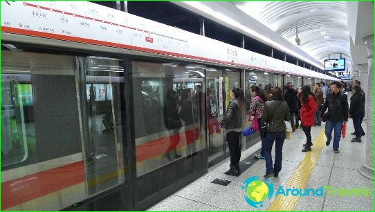
The Shenyang Metro starts operating at 6 a.m. and closes at 11 p.m. Train intervals depend on the time of day and do not exceed 3-5 minutes during peak hours. All station names and signs in the metro are duplicated in English.
Photos of Shenyang subway
-
Shenyang Metro Map
-
-
-
